
Page 46 - October Sun Rays_Text _proof_FinalTrim
P. 46
Continued from the previous page service to users of the Bur Oak Trail. maps provide instructions for exploring
During a 2016 thunderstorm, the enor- these main routes and suggest alternatives
to. The CA’s Landscape Maintenance staff, mous tree toppled to the earth. At the for varying the trail distance.
in consultation with the Hiking Club’s Trail request of trail advocates, a resourceful This Sun City Trail Routes document
Development Team, coordinated the proj- CA staff member with years of experi- has recently been posted on the Sun City
ect and placed the markers approximately ence in the manufacture of custom wood website. It complements the Nature Trails
one-tenth mile apart along the trail system furniture crafted four rustic benches for & Walking Paths color brochure, a joint
at waypoints which had been mapped by placement along the new Bur Oak Trail. project of the Sun City Nature Club and
Hiking Club volunteers. EXPLORING SUN CITY’S TRAILS Del Webb, which is available at major
Bur Oak and Berry Creek Trails repre- trailheads.
A Hiking Club work crew then set the sent only a sampling of the extensive route CONTINUING THE MOMENTUM
markers in the ground and provided the options available to residents who enjoy These impressive improvements to our
City of Georgetown’s Mapping & GIS De- spending time outdoors. Sun City Trail community’s outdoor amenities illustrate
partment with the final set of coordinates Routes, a document compiled by the Hiking the commitment of residents and manage-
for integration in the city’s master GIS Base Club, incorporates both nature trails and ment alike to work together on projects
Map for reference by first responders. concrete sidewalks into 10 major walking which not only foster our active lifestyle
routes which depart from central points but also showcase the many undeveloped
The Georgetown Fire Department an- within the community. The accompanying areas of natural beauty in our community.
ticipates all trail markers will be tied to
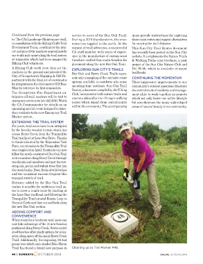
emergency services by late fall 2016. Watch Cleaning up at Trail Marker #48. ONLINE: SCTEXAS.ORG
the CA Communicator for details on an
upcoming special event designed to intro-
duce residents to the new Emergency Trail
Marker system.
EXTENDING THE TRAIL SYSTEM
For years, trail users have been intrigued
by the heavily wooded terrain which lies
across Berry Creek from the Tranquility
Trail trailhead at Lone Star Drive. Thanks
to funds allocated by the Expansion Task
Force, an extension to the Tranquility Trail
was completed in April. Residents can now
follow the newly-constructed Bur Oak Trail
as it meanders along Berry Creek through
woodlands and meadows and past the tow-
ering oak, pecan and walnut trees that line
the creek banks. Deer, flocks of wild turkey
and the occasional raccoon frequent this
tranquil stretch of trail.
Distance added by the Bur Oak Trail
makes it possible for ambitious trail us-
ers to cover a 4-mile route by starting at
the Lone Star trailhead and following the
Tranquility Trail around Bonita Loop to
Summit Circle and then out and back along
the new Bur Oak section.
ADDING COMFORT AND
CONVENIENCE
When ready for a brief rest, trail users can
now take advantage of the 11 new benches
positioned along Berry Creek. Seven coated
steel benches offer shady options for relax-
ation along spurs off the main Berry Creek
Trail. Additionally, the imposing, 90 foot
pecan tree which once shaded Blue Heron
Trail has found a brand new purpose in
44 | SUNRAYS OCTOBER 2016