Street Name History
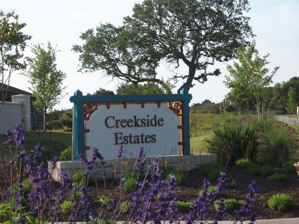
Creekside Estates – Street Name History
Thank you Rita Springer for your research on where our neighborhood street names originated. The names are all lovely waterways around Texas.
Coleto Creek
 Coleto Creek is formed by the confluence of several waterways in Victoria County and flows southeast for twenty-five miles to its mouth on the Guadalupe River, six miles south of Victoria and forms part of the county line between Goliad and Victoria counties. In the area flat to rolling prairie is surfaced by permeable sand that supports mesquite and a variety of prairie grasses. The creek is impounded to form Coleto Creek Reservoir, which lies on the boundary of Victoria and Goliad counties and about 90 miles northeast of Corpus Christi, Texas. The name Coleto means someone or something from the Mayan Indian culture of the colonial town of San Cristobal de Las Casa in Chiapas, Mexico. They serve traditional dishes such as tamales Coleto, Coleto bread, Asado Coleto, and a Coleto breakfast.
 The Battle of Coleto was fought in March, 1836, during the Goliad campaign and was one of the most significant engagements of the Texas Revolution. In February, General Jose de Urrea , led a branch of the Mexican army up the Gulf Coast of Mexican Texas toward Goliad, where a large contingent of soldiers from the Texian Army were garrisoned under Colonel James W. Fannin. Simultaneously, Mexican president Antonio Lopez de Santa Anna led a larger force into the Texan interior, where on March 6 his troops won the Battle of the Alamo. After learning of the Alamo's defeat, Texian General Sam Houston ordered Fannin to retreat from Goliad and join the rest of the army in Victoria. The Battle of San Jacinto was then the concluding military event of the Texas Revolution in April 1836.
More information: Coleto Creek Park.
Duck Creek
 Duck Creek, near Dallas, was named for the numerous ducks that gathered at its water holes and small lakes. The long creek runs for many miles with branches that flow through the surrounding counties of Dallas, Dickens, Cooke, Van Zandt, Robertson, and Smith. In addition to creating many small local lakes, it also flows into the two large reservoirs of Lake Ray Hubbard and Lake Tawakoni. The stream traverses flat terrain with local shallow depressions, surfaced with clay and sandy loams that support water-tolerant hardwoods, conifers, and grasses.
 Duck Creek, Texas was the name of two English communities, sometimes called Old Duck Creek and New Duck Creek, located in northeastern Dallas County, within the present city limits of Garland, fifteen miles northeast of Dallas. In 1886, first the Gulf, Colorado and Santa Fe and then the Dallas and Greenville railroads bypassed Duck Creek. The Santa Fe built a depot about a mile to the east, while the Missouri, Kansas, and Texas railroad (which had acquired the Dallas and Greenville) established a depot less than a mile to the north. Both railroads bought land from the same land owner and laid out their towns adjacent to their depots. The community established by the Santa Fe was named Embree and the community laid out by the MK&T took the name Duck Creek, and was also known as New Duck Creek. Thereafter, residents of Old Duck Creek moved to one or the other of the new communities.
 New Duck Creek and Embree engaged in an intense rivalry, with several attempts made by one town to take over the other. A congressman, who was traveling to Washington for the opening of Congress, stopped in at the request of local residents to look at the situation. Shortly afterward he succeeded in having the post office moved to a site midway between the two depots. The new post office, established in 1887 was named Garland. In 1891, Garland was incorporated and absorbed both Duck Creek and Embree.
More information: Duck Creek
Hubbard Creek
Hubbard Creek rises 3 miles northwest of Baird in north central Callahan County and runs 62 miles northeast across Shackelford County to its mouth on the Clear Fork of the Brazos River, ten miles north of Breckenridge in nor Stephens County. The stream is intermittent in its upper reaches. It crosses flat, flood-prone terrain with local shallow depressions, surfaced by clay and sandy loams that support water-tolerant hardwoods, conifers, and grasses. The creek is dammed to form Hubbard Creek Reservoir in Stephens County. Hubbard Creek was named after one of the supervising surveyors of the Texas Emigration and Land Company.
In 1862 William Henry Ledbetter, a native of Mississippi, founded a salt works at a saline spring on the Salt Fork of Hubbard Creek near the town of Albany. The spring was first discovered when three cattlemen who were returning from a cattle drive to the Concho River area to the west, found it while walking across country after losing their horses. Ledbetter Salt Works was the only source of salt in this area to the settlers and some of which went to supply Confederate forces during the Civil War. Because of its isolation, the saltworks was frequently subject to Commanche Indian raids. One of Ledbetter's sons wandered off from school one day and they assumed he was carried away by Commanches and was never found.
Hubbard Creek Lake is located in Breckenridge, the county seat of Stephens County, four miles east of Hubbard Creek Reservoir in the Brazos River, 51 miles northeast of Abilene and west of Fort Worth. Construction began in March 1, 1961 and the dam was completed in November 26, 1962. The predominant fish species are large mouth bass, white crappie, channel, flathead, and blue catfish, white bass and freshwater drum.
More information: Hubbard Creek
Pedernales
The name Pedernales River translates from the Spanish as River of Flint due to the abundance of flint rocks found in the riverbed and frequently quarried by Native Americans to fashion flint tools. The Pedernales River (pronounced "Perdenales" by native Texans) rises from springs in the southeastern corner of Kimble County and flows northeast for 106 miles, crossing Gillespie, Blanco, and Hays counties, to the confluence of the Colorado River above Lake Travis and Austin. The surrounding land is rocky and rugged, with the ground rising at the top of the Texas Hill Country to form a river valley below. Two State Parks have been established along the Pedernales River. Pedernales Falls State Park is fourteen miles east of Johnson City in Blanco County. The Lyndon B. Johnson State Park and Historic Site, is near Stonewall, on the south bank of the Pedernales River. Stonewall is the birthplace and death place of former U.S. President Lyndon Johnson, and his LBJ Ranch (much of which is now the Lyndon B. Johnson National Historical Park).
Pedernales, Texas was on State Highway 16 and the Pedernales River, 7 miles southwest of Fredericksburg in southern Gillespie County. It was settled in the late 1840s by German immigrants, among who were Karl Friedrich Hermann Lungkwitz and Friedrich Richard Petri, both famous painters from Dresden, Saxony. In 1846, Wilhelm Victor Keidel moved to Fredericksburg, becoming Gillespie County's first physician and first Chief Justice. Keidel then relocated to Pedernales and offered to any settlers who would relocate with him free medical care. By the late 1860s Pedernales had a school of its own, two stores, and a gin. By 1990, little remained of the community besides the school building, which had be renovated and was used as a private home.
More information: Pedernales River
Pipe Creek
 Pipe Creek originates in an area of the Edwards Plateau characterized by steep slopes and limestone benches covered by shallow clay loam soils. Pipe Creek rises eight miles west of Boerne in southwestern Kendall County and runs south for nine miles, through Kendall and Bandera counties, to its mouth on Red Bluff Creek, two miles south of the town of Pipe Creek.
Pipe Creek rises eight miles west of Boerne in southwestern Kendall County and runs south for nine miles, through Kendall and Bandera counties, to its mouth on Red Bluff Creek, two miles south of the town of Pipe Creek. Pipe Creek originates in an area of the Edwards Plateau characterized by steep slopes and limestone benches covered by shallow clay loam soils. The uppermost portion of Pipe Creek runs through forests of live oak and Ashe juniper and then open stands of live oak, and mesquite with clearings of mixed grasses, persimmon, and prickly pear. Near the town of Pipe Creek the terrain becomes flatter and locally dissected, and the soil becomes stony. Pipe Creek contributes to the Medina River which then forms Medina Lake northwest of San Antonio.

Stories concerning Pipe Creek's name vary considerably. According to the most popular, an Anglo settler pursued by Indians dropped his pipe beside this creek, stopped to retrieve it, and still made good his escape.
Pipe Creek, Texas was founded in 1870 by Roman Catholic immigrants from Poland. The population consisted mostly of farmers and ranchers, who raised cotton, corn, cattle, and sheep, and also produced molasses. Stagecoaches from San Antonio to Bandera provided travel and mail services.

Pipe Creek is located about 45 miles northwest of San Antonio. The current population is around one hundred. It is in the middle of the Texas Hill Country and home to large ranches, small spring-fed lakes, wildlife, and near Bandera, Texas which is billed as the Cowboy Capital of the World. The television show, The Cisco Kid, was filmed at the Flying L Ranch in this area.
More information: Pipe Creek