Tuesday, March 16, 2021
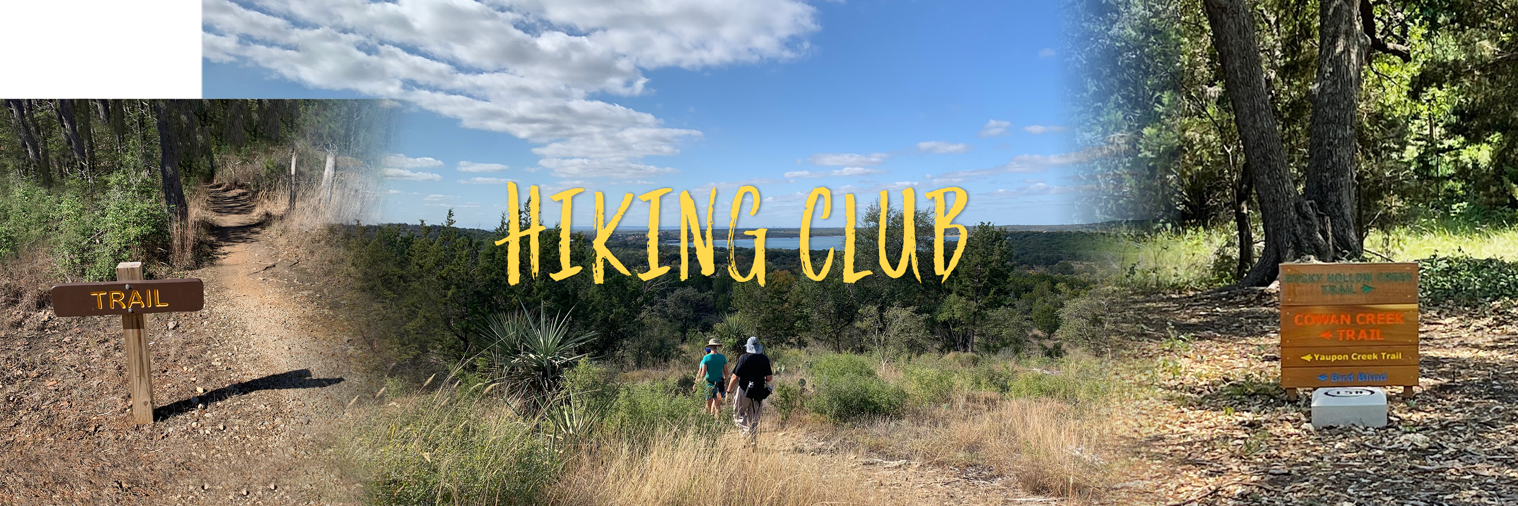
Hike Leaders: Level 1 Plus: Jerry Ferguson 515-490-4999 [email protected] Level 2 Plus: Bill Corbett 512-869-9359 [email protected] Level 3: Kathy Corbett 512-680-3881 [email protected] Hike Location: Town of Lakeway, off FM 620, past Mansfield Dam Hike Level/Length/Duration: Level 1 Plus (easy-plus): 4.0 miles (about 2.5 hours on the trail). Led by Jerry Ferguson. This group will hike trails in the Hamilton Greenbelt area. Level 2 Plus (moderate-plus): 8.7 miles (about 5 hours on the trail). Led by Bill Corbett. This group will hike trails in both the Hamilton Greenbelt and nearby Canyonlands areas, with an on-trail lunch in between the two destinations. Level 3 (difficult): 11.0 miles (about 7 hours on the trail); Led by Kathy Corbett. This group will add a climb up Mount Lakeway in Canyonlands and a steep rocky path at the Lake Travis end of Hamilton Greenbelt, with an on-trail lunch in between the two destinations. Hike Details: Hikers in the LEVEL 1 Plus group will explore 4.0 miles in the Hamilton Greenbelt area, starting along level crushed granite trails that meander through woodlands along spring-fed Hurst Creek and Yaupon Creek. The group will then hike more rugged and hilly sections (with short stretches of steep and rocky terrain) as the route continues past an observation deck above Hurst Creek and on to the point where the trail meets the Hurst Creek Arm of Lake Travis. Hikers in the LEVEL 2 Plus group will start at the Canyonlands trails. This 4.7-mile route begins on the rim of the canyon which forms the upper reaches of Rough Hollow Cove, another major arm of Lake Travis. After hiking down to the canyon floor on fairly steep and narrow paths, the group will follow Rough Hollow Creek, returning to the rim at the turn-off for Mount Lakeway and continuing on the Mount Lakeway trail for a short distance. The group will then visit a natural feature being explored by the club for the first time this year: a scenic "Hidden Grotto" on Rough Hollow Creek. This new route then parallels that creek before returning to the rim. The group will then descend to the canyon floor once again and circle a seasonal pond before climbing the steep path that leads back to the trailhead. The group will then drive to the Hamilton Greenbelt trailhead for a picnic lunch. After their break, they will traverse the 4.0-mile Hamilton Greenbelt route described above for the Level 1 Plus group. Hikers in the LEVEL 3 will explore the same route as the Level 2 route, with one significant exception: this group will add to their adventure by tackling the strenuous 2.0-mile round-trip climb to the top of Canyonlands' Mount Lakeway and later the steep and rocky 0.3-mile Upper Trail at Hamilton Greenbelt. Only experienced Hiking Club members should sign up for this hike. Please contact the Hike Leader if you have ANY questions. TRANSITIONAL GUIDELINES WILL BE ENFORCED, WITH NO EXCEPTIONS, ON THIS HIKE. ENSURE YOU HAVE A MASK (FACE COVERING) AND HAND SANITIZER. New members are STRONGLY encouraged to contact the Hike Leader(s) for additional details. The Level 2 Plus and Level 3 hikes are excellent conditioning hikes for the Half & Full Marathons coming up in March. Hike Essentials: - Hiking Boots (required)
- Hiking Sticks or Poles (highly recommended)
- Hat and Sunscreen
- 2-plus Quarts of Water (essential)
- On-trail Snacks
- Picnic Lunch for Level 2 Plus & Level 3 hikers (kept in car coolers)
- Name Badge and Medical ID Tag
Meeting Time/Location: Level 1 Plus: Meet at 8:00 AM, Level 2 Plus: Meet at 7:30 AM and Level 3: Meet at 7:00 AM. All groups will meet at Legacy Hills Pavilion. Please show up 5-15 minutes early; we will depart promptly upon completion of check-in procedures. Restrooms: Legacy Hills Pavilion and at both the Hamilton Greenbelt trailhead and at the Canyonlands half-mile mark. Lunch Plans: Level 1 Plus: On your own for lunch. Level 2 Plus & Level 3: Bring a sack lunch to enjoy between hike destinations at the Hamilton Greenbelt trailhead picnic area. Background Information: Located on Lake Travis between Mansfield Dam and US Hwy 71, the Lakeway community has mushroomed since its beginnings as a small resort and vacation home destination in 1962 to a city of 12,000 permanent residents. In addition to its remodeled resort and spa, Lakeway features several golf courses, marinas, a private airpark, a yacht club, a trendy restaurant, a swim center and a major tennis complex. The drive to Lakeway along FM 620 goes past Comanche Trail, the turn-off to the iconic Oasis restaurant complex overlooking Lake Travis and Hippie Hollow's fabled "clothing optional" beach. Information on Lakeway trails is provided by the city's Parks Department at www.lakeway-tx.gov. Driving Distance to Trailhead: 45 miles (60 to 90 minutes in heavy traffic) Driving Directions: NOTE THAT THE 30 MPH SPEED LIMIT ON LAKEWAY ROADS IS STRICTLY ENFORCED!!! Be aware in the descriptions below for the difference between Lakeway Drive and Lakeway Blvd., which are intersecting roads. To Entrance to Lakeway Community: Go west on Williams Dr. (RR2338) to CR 3405. Left on 3405. Proceed to Ronald Reagan. Turn left on Ronald Reagan. Turn right on Hero Way and proceed to the intersection with Toll 183-A. Turn left (south) onto Toll 183-A and continue to the exit for US 183/Avery Ranch/Lakeline Blvd/Lakeline Mall Rd. Stay on the feeder road to the intersection with FM 620 W. Turn right on FM 620 W and continue for fifteen (15) miles. The entrance to Lakeway will be at Lakeway Blvd. Turn right at Lakeway Blvd. To Hamilton Greenbelt Trailhead: Turn right onto Lakeway Blvd. and proceed 1.2 miles to Lohman's Crossing Rd. Turn right on Lohman's Crossing Rd. and proceed 0.2 miles to Hamilton Greenbelt Trailhead on the right. Park in Trailhead Parking lot where there are restrooms and water fountains. To Canyonlands Trailhead: On Lakeway Blvd continue approximately 1.0 mile and then turn left on Hills Blvd. Then turn right on Trophy Drive and drive about 100 feet to park on the right side of the street. Trailhead is on your left. To Hamilton Greenbelt Trailhead from Canyonlands Trailhead: From Trophy Drive turn right on Highland Blvd then right on Lakeway Blvd. Then at the signal for Lohman's Crossing, turn left. Proceed 0.2 miles to Hamilton Greenbelt Trailhead on the right. Park in Trailhead Parking lot. To FM 620 from Hamilton Greenbelt Trailhead: Turn left out of the parking lot onto Lohman's Crossing. Then turn left again on Lakeway Blvd. Then left on FM 620. Choose your preferred route back to Sun City. |